ROT13

ROT13-es

ROT13rotar 13 posiciones», a veces con un guion: ROT-13) es un sencillocifrado César utilizado para ocultar un texto sustituyendo cada letra por la letra que está trece posiciones por delante en el alfabeto. Ase convierte en N, B se convierte en Oy así hasta la M, que se convierte en Z. Luego la secuencia se invierte: N se convierte enA, O se convierte en B y así hasta la Z, que se convierte en M. Este algoritmo se utiliza en foros de Internet como medio para ocultar de miradas casuales el final de unchiste, la solución a un acertijo, un spoiler de una película o una historia, o algúntexto ofensivo. ROT13 se ha descrito como el «equivalente en Usenet de una revista que imprime bocabajo la respuesta a un pasatiempo».1

El nombre «ROT13» se originó en Usenet a principios de los años 1980, y el método se ha convertido en un estándar de facto. Al igual que el cifrado de César (un método de cifrado con miles de años), el ROT13 no proporciona seguridad criptográfica real y no se usa para tales fines; de hecho, a menudo se emplea como ejemplo canónico de cifrado débil. Otra característica de este cifrado es que es simétrico; esto es, para deshacer el ROT13, se aplica el mismo algoritmo, de manera que para cifrar y descrifrar se puede utilizar el mismo código.

Descripción

Aplicar el ROT13 a un texto se reduce a examinar sus caracteres alfabéticos y sustituirlos por la letra que está 13 posiciones por delante en el alfabeto, volviendo al principio si es necesario y conservando las mayúsculas y minúsculas: a se convierte en n, B se convierte en O, y así hasta la Z, que se convierte en M. Solo quedan afectadas las letras que aparecen en el alfabeto latino; los números, símbolos, espacios y otros caracteres se dejan igual. Como hay 26 letras en el alfabeto latino y 26 = 2 × 13, la función ROT13 es su propiainversa:

\mbox{ROT}_{13}(\mbox{ROT}_{13}(x))=\mbox{ROT}_{26}(x)=x para cualquier texto x.

En otras palabras, dos aplicaciones sucesivas de ROT13 recuperan el texto original (en matemáticas, esto a veces se llama involución; en criptografía, un cifrado recíproco).

La transformación se puede hacer utilizando una tabla de búsqueda como la siguiente:

ABCDEFGHIJKLMNOPQRSTUVWXYZabcdefghijklmnopqrstuvwxyz
NOPQRSTUVWXYZABCDEFGHIJKLMnopqrstuvwxyzabcdefghijklm

Por ejemplo, en este chiste, la respuesta se ha ocultado usando ROT13:

¿Cómo se puede distinguir a un extrovertido de un
introvertido en la NSA? Ra ybf nfprafberf,
ry rkgebiregvqb zven ybf mncngbf qr ybf BGEBF gvcbf.

Transformando todo el texto mediante el ROT13, se revela la respuesta al chiste:

¿Pbzb fr chrqr qvfgvathve n ha rkgebiregvqb qr ha
vagebiregvqb ra yn AFN? En los ascensores,
el extrovertido mira los zapatos de los OTROS tipos.

Una segunda aplicación del ROT13 recuperaría el original.

____________________________………………………=================================

ROT13

From Wikipedia, the free encyclopedia

ROT13 replaces each letter by its partner 13 characters further along the alphabet. For example,HELLO becomes URYYB (or, reversing, URYYB becomesHELLO again).

ROT13 (“rotate by 13 places“, sometimes hyphenated ROT-13) is a simple lettersubstitution cipher that replaces a letter with the letter 13 letters after it in the alphabet. ROT13 is an example of the Caesar cipher, developed in ancient Rome.

In the basic Latin alphabet, ROT13 is its own inverse; that is, to undo ROT13, the same algorithm is applied, so the same action can be used for encoding and decoding. The algorithm provides virtually nocryptographic security, and is often cited as a canonical example of weak encryption.

ROT13 is used in online forums as a means of hiding spoilers, punchlines, puzzle solutions, and offensive materials from the casual glance. ROT13 has been described as the “Usenet equivalent of a magazineprinting the answer to a quiz upside down“.[1] ROT13 has inspired a variety of letter and word games on-line, and is frequently mentioned in newsgroup conversations.

Description

Applying ROT13 to a piece of text merely requires examining its alphabetic characters and replacing each one by the letter 13 places further along in thealphabet, wrapping back to the beginning if necessary.[2] A becomes N, B becomes O, and so on up to M, which becomes Z, then the sequence continues at the beginning of the alphabet: N becomes A, O becomes B, and so on to Z, which becomes M. Only those letters which occur in the English alphabet are affected; numbers, symbols, whitespace, and all other characters are left unchanged. Because there are 26 letters in the English alphabet and 26 = 2 × 13, the ROT13 function is its own inverse:[2]

\mbox{ROT}_{13}(\mbox{ROT}_{13}(x))=x for any basic Latin-alphabet text x.

In other words, two successive applications of ROT13 restore the original text (inmathematics, this is sometimes called an involution; in cryptography, a reciprocal cipher).

The transformation can be done using a lookup table, such as the following:

ABCDEFGHIJKLMNOPQRSTUVWXYZabcdefghijklmnopqrstuvwxyz
NOPQRSTUVWXYZABCDEFGHIJKLMnopqrstuvwxyzabcdefghijklm

For example, in the following joke, the punchline has been obscured by ROT13:

Why did the chicken cross the road?
Gb trg gb gur bgure fvqr!

Transforming the entire text via ROT13 form, the answer to the joke is revealed:

Jul qvq gur puvpxra pebff gur ebnq?
To get to the other side!

A second application of ROT13 would restore the original.

BOMBAY – GEOGRAFÍA

640px-Bombay_Municipal_Corporation

GEOGRAFÍA

UBICACIÓN

Bombay se encuentra en las costa del mar Arábigo en el oeste de la India a 18,96 º Lat N y 72,82 º Long E. La altitud media de la ciudad es de once msnm.

Los 437,77 km² del área metropolitana ocupan dos islas situadas frente a la costa que están unidas por puentes. El centro urbano de Bombay se encuentra en la isla homónima de 70 km² de superficie situada al sur, mientras que el resto de la región metropolitana, que agrupa los barrios periféricos y la ciudad de Thane, ocupan la mayor parte de los 533 km² de la isla de Salsette al norte.

Ambas islas están separadas entre sí y del continente por estrechos brazos de mar. Aparte de algunas elevaciones bruscas y aisladas de hasta 496 m de altura, las islas son llanas e incluso algunas partes de la isla de Bombay se encuentran por debajo del nivel del mar.

Al este se extiende el Konkan, nombre que recibe la franja costera de Maharashtra de unos 80 km de longitud, tras la cual se encuentran los Ghats Occidentales, cordillera de 1600 m de altura media que separa la franja costera de la meseta del Decán. El transporte con el Este resulta difícil debido a las bruscas laderas de la cordillera.

División territorial

Bombay se encuentra dividida en seis zonas (zones, en inglés). Éstas se dividen a su vez en 24 distritos urbanos (wards). Las zonas están designadas por números y los distritos urbanos por letras. Además, los distritos urbanos se dividen en un total de 221 distritos electorales. La siguiente tabla muestra las zonas individuales con sus distritos urbanos correspondientes.

Zona 1 Zona 2 Zona 3 Zona 4 Zona 5 Zona 6
Ward A Ward F/North Ward H/East Ward P/North Ward L Ward N
Ward B Ward F/South Ward H/West Ward P/South Ward M/East Ward S
Ward C Ward G/North Ward K/East Ward R/North Ward M/West Ward T
Ward D Ward G/South Ward K/West Ward R/South
Ward E Ward R/Central

Clima

Puesta de sol vista desde Bandstand, Bombay. La ciudad presenta un clima tropical.

La ciudad de Bombay se encuentra en zona climática tropical. La temperatura media anual asciende a 26,7 °C. Las temperaturas son moderadas por la proximidad del mar y no sufren grandes variaciones a lo largo del año.

El mes más frío es enero, con una media de 23,9 °C a mediados del mes.

Los monzones influyen más que la temperatura sobre los cambios de clima a lo largo del año. La época de monzones (chatur-masia, o ‘cuatro meses’) se extiende normalmente entre el comienzo de junio y el final de septiembre. Las precipitaciones alcanzan los 1700 mm durante estos meses, un 95 % del total anual. Los meses siguientes de octubre y noviembre son igualmente cálidos, aunque sin apenas precipitaciones.

Con temperaturas máximas diarias de unos 28 °C, los meses de diciembre a febrero son secos y ligeramente menos cálidos que los meses de marzo a mayo, cuando las temperaturas máximas diarias alcanzan los 33 °C y aumenta la humedad ambiental.

_________________________::::………………………………..===============================

Geography

Mumbai is on a narrow peninsula on the southwest of Salsette Island, which lies between the Arabian Sea to the west, Thane Creek to the east, and Vasai Creek to the north. Mumbai's suburban district occupies most of the island. Navi Mumbai is east of Thane Creek, and the Thane District is north of Vasai Creek.

Mumbai consists of two revenue districts

Mumbai metropolitan region, Landsat 5 satellite image, 2011-01-30

Mumbai consists of two distinct regions: Mumbai City district and Mumbai Suburban district, which form two separate revenue districts of Maharashtra.[109] The city district region is also commonly referred to as the Island City or South Mumbai.[15] The total area of Mumbai is 603.4 km2 (233 sq mi).[110] Of this, the island city spans 67.79 km2 (26 sq mi), while the suburban district spans 370 km2 (143 sq mi), together accounting for 437.71 km2 (169 sq mi) under the administration of Brihanmumbai Municipal Corporation (BMC). The remaining area belongs to Defence, Mumbai Port Trust, Atomic Energy Commission and Borivali National Park, which are out of the jurisdiction of the BMC.[111]

Mumbai lies at the mouth of the Ulhas River on the western coast of India, in the coastal region known as the Konkan. It sits on Salsette Island, partially shared with the Thane district.[112] Mumbai is bounded by the Arabian Sea to the west.[113] Many parts of the city lie just above sea level, with elevations ranging from 10 m (33 ft) to 15 m (49 ft);[114] the city has an average elevation of 14 m (46 ft).[115]Northern Mumbai (Salsette) is hilly,[116] and the highest point in the city is 450 m (1,476 ft) at Salsette in the PowaiKanheri ranges.[117] Sanjay Gandhi National Park (Borivali National Park) is located partly in the Mumbai suburban district, and partly in the Thane district, and it extends over an area of 103.09 km2 (39.80 sq mi).[118]

Apart from the Bhatsa Dam, there are six major lakes that supply water to the city: Vihar, Lower Vaitarna, Upper Vaitarna, Tulsi, Tansa and Powai. Tulsi Lake and Vihar Lake are located in Borivili National Park, within the city’s limits. The supply from Powai lake, also within the city limits, is used only for agricultural and industrial purposes.[119] Three small rivers, the Dahisar River, Poinsar (or Poisar) and Ohiwara (or Oshiwara) originate within the park, while the pollutedMithi River originates from Tulsi Lake and gathers water overflowing from Vihar and Powai Lakes.[120] The coastline of the city is indented with numerous creeks and bays, stretching from Thane creek on the eastern to Madh Marve on the western front.[121] The eastern coast of Salsette Island is covered with large mangroveswamps, rich in biodiversity, while the western coast is mostly sandy and rocky.[122]

Soil cover in the city region is predominantly sandy due to its proximity to the sea. In the suburbs, the soil cover is largely alluvial and loamy.[123] The underlying rock of the region is composed of blackDeccan basalt flows, and their acidic and basic variants dating back to the late Cretaceous and earlyEocene eras.[124] Mumbai sits on a seismically active zone owing to the presence of 23 fault lines in the vicinity.[125] The area is classified as a Seismic Zone III region,[126]which means an earthquake of up to magnitude 6.5 on the Richter-scale may be expected.[127]

Climate

Average temperature and precipitation in Mumbai

Main article: Climate of Mumbai

Mumbai has a tropical climate, specifically a tropical wet and dry climate (Aw) under the Köppen climate classification, with seven months of dryness and peak of rains in July.[128] The cooler season from December to February is followed by the summer season from March to June. The period from June to about the end of September constitutes the south-west monsoon season, and October and November form the post-monsoon season.[129]

Between June and September, the south west monsoon rains lash the city. Pre-monsoon showers are received in May. Occasionally, north-east monsoon showers occur in October and November. The maximum annual rainfall ever recorded was 3,452 mm (136 in) for 1954.[130] The highest rainfallrecorded in a single day was 944 mm (37 in) on 26 July 2005.[131] The average total annual rainfall is 2,146.6 mm (85 in) for the Island City, and 2,457 mm (97 in) for the suburbs.[130]

The average annual temperature is 27.2 °C (81 °F), and the average annual precipitation is 2,167 mm (85 in).[132] In the Island City, the average maximum temperature is 31.2 °C (88 °F), while the average minimum temperature is 23.7 °C (75 °F). In the suburbs, the daily mean maximum temperature range from 29.1 °C (84 °F) to 33.3 °C (92 °F), while the daily mean minimum temperature ranges from 16.3 °C (61 °F) to 26.2 °C (79 °F).[130] The record high is 40.2 °C (104 °F) on 28 March 1982,[133] and the record low is 7.4 °C (45 °F) on 27 January 1962.[134]

Fuente:

http://es.wikipedia.org

INDIANA – GEOGRAFÍA

GEOGRAFÍA

Indiana limita al norte con el lago Míchigan y con Míchigan, al este con Ohio, al sureste y al sur con Kentucky y al oeste con Illinois. Indiana es uno de los estados de los Grandes Lagos.

WabashrivermapMississippi17.bmp

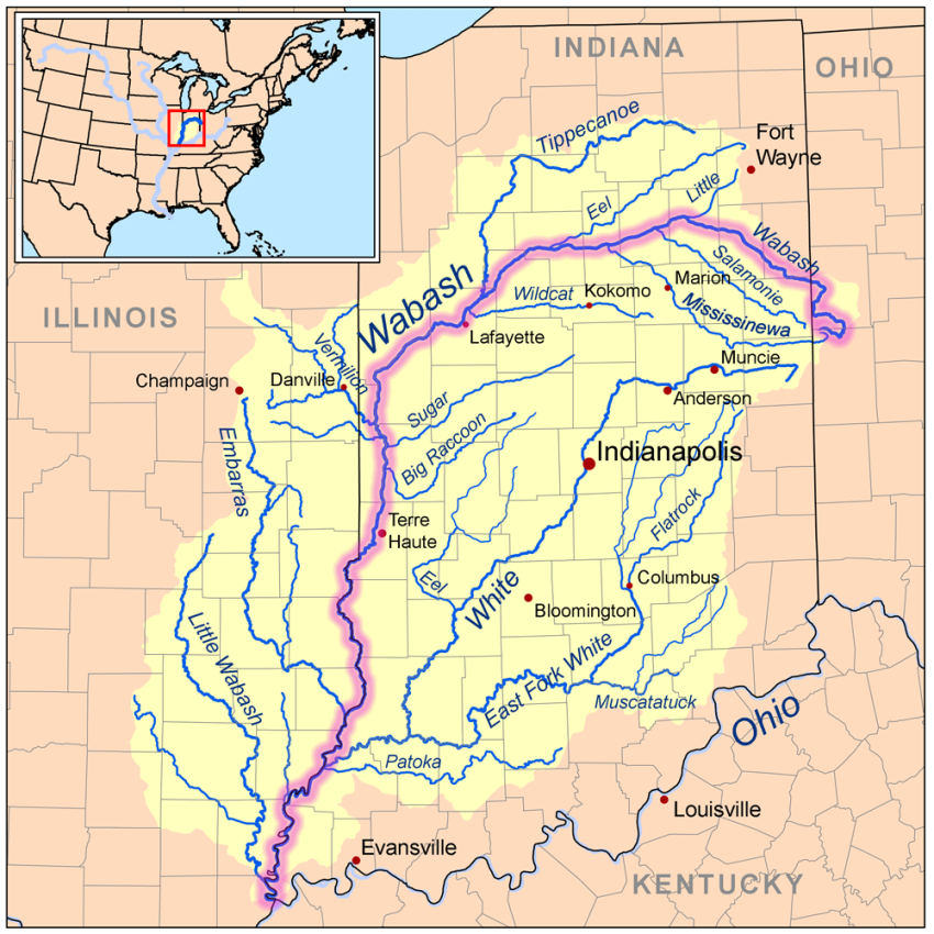
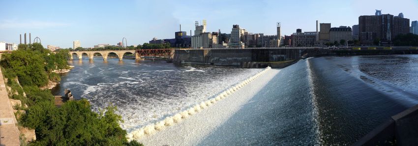
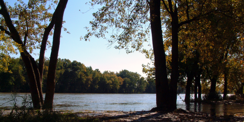
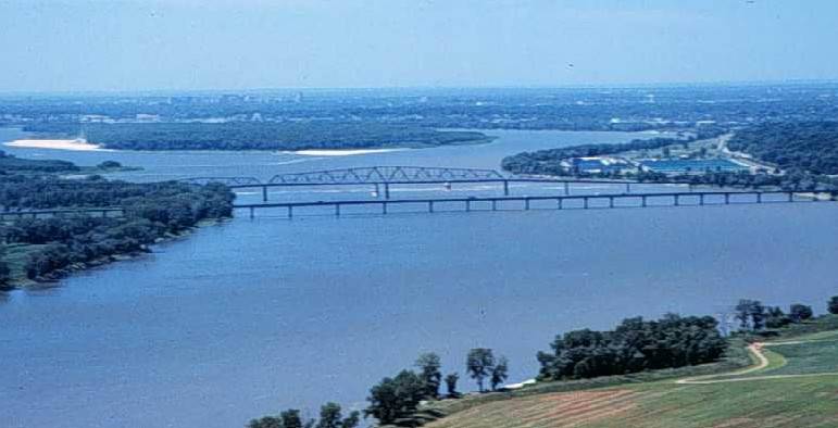
El río Wabash corta a Indiana por cerca de 650 kilómetros, en sentido nordeste-suroeste. Es un afluente del río Ohio, toda vez que afluente del río Misisipi. Lacuenca hidrográfica de éste último cubre la mayor parte del estado. El Wabash ha dado nombre y temática a dos canciones estatales: On the Banks of the Wabash yWabash Cannonball.8 9 A orillas del río Blanco (White River) (un afluente del Wabash, que zigzaguea por el centro del estado) se localizan dos grandes ciudades, que sonIndianápolis y Muncie. Evansville, la tercera mayor ciudad del estado, está localizada a orillas del río Ohio, que delimita toda la frontera de Indiana con Kentucky. Otro río importante es el St. Joe. El Wabash

La mayor parte del norte y centro de Indiana son tierras de cultivos salpicadas de pequeñas ciudades, como North Manchester.

Lake_Michigan_Landsat_Satellite_Photo 1024px-Great_Lakes_1Great_Lakes_from_space_crop_labeled

Noroeste de Indiana

La esquina noroeste del estado forma parte del área metropolitana de Chicago(ciudad localizada en el estado vecino de Illinois), y está, por tanto, densamente poblada, con más de 1 millón de habitantes.10 Gary, junto con las ciudades que conforman la mitad norte de los condados de Lake, Porter, y LaPorte, son suburbiosde Chicago. Todos están en la Zona Horaria Central, al igual que Chicago. Están comunicados con la metrópoli a través de una vía férrea de lka South Shore Electric.11

662px-Seal_of_Kentucky.svg 675px-Flag_of_Wisconsin.svg 778px-Flag_of_Illinois.svg750px-Flag_of_Indiana.svg

South Bend / Centro Norte de Indiana

South Bend, Mishawaka, Elkhart y Goshen, en el centro norte de Indiana, conforman la región conocida como Michiana. Estas ciudades, que la Oficina del Censo de EE.UU. ha agrupado en dos áreas metropolitanas, se han convertido a lo largo de los últimos 10 años en una única área metropolitana, que comprende tanto el condado de St. Joseph como el de Elkhart.

El río Kankakee, que serpentea por el norte de Indiana, sirve como línea divisoria entre la Indiana rural y la suburbana.12

2008-0705-MPLStour-StAnthonyFalls-PAN

Indiana Central

La capital estatal, Indianápolis, está situada en la parte central del estado.13 Una ciudad cercana es Columbus, conocida por su rico y moderno patrimonioarquitectónico.

Sur de Indiana

Evansville es la tercera mayor ciudad de Indiana, localizada en la esquina suroeste del estado.14

El sur de Indiana es una mezcla de tierras de labranza y bosques. El Hoosier National Forest es una reserva natural de 80.900 hectáreas situada en el centro sur del estado. La topografía de la parte sur del estado es más variada y, generalmente, más accidentada que la parte septentrional. En esta región se sitúan los “knobs”, una serie de colinas de unos 300 m de altitud, que corren paralelas al río Ohio. La geologíacaliza del sur de Indiana ha permitido la excavación natural de numerosas cuevas. Indiana alberga una de las mayores regiones de canteras calizas de EE.UU.

Wabash_River_at_WilliamsportMiss_R_dam_27

Las áreas bajo gestión del Servicio Nacional de Parques son:15

Regiones fisiográficas

Regiones fisiográficas de Indiana.

Podemos dividir a Indiana en tres regiones fisiográficas:

  • Las Llanuras de los Grandes Lagos ocupan la región norte de Indiana. Esta región se caracteriza por sus pequeños y numerosos lagos y montes poco elevados, compuestos por sedimentos dejados por los glaciares. Su sueloes muy fértil, y la mayor parte de la región se usa para la práctica de la agricultura.
  • Las Llanuras Till ocupan la región central de Indiana. Las altitudes de estasllanuras aumentan gradualmente a medida en que se viaja en dirección al sur. Estas llanuras cuentan con pocos accidentes geográficos, y se caracterizan por sus montes bajos y anchos. Su suelo es fértil, aunque no tanto como en las Llanuras de los Grandes Lagos. El punto más alto de Indiana se localiza en esta región —la Hoosier Hill—, con 383 metros de altitud, localizada en elCondado de Wayne.
  • Las Llanuras y Colinas del Sur ocupan la región sur de Indiana. Es la única de las tres regiones que no fue cubierta por los glaciares durante la Edad de Hielo. Por ello, tiene el terreno más accidentado del estado. Gran parte de esta región está cubierta por bosques. El punto más bajo de Indiana se localiza en esta región, en su extremo suroeste.

Clima

Atardecer en una autopista de Indiana.

El clima de Indiana es continental, en el que se distinguen cuatro estaciones, converanos cálidos e inviernos fríos. Las temperaturas, durante todo el año, descienden a medida que aumenta lalatitud —a excepción del extremo noroeste del Estado, donde la presencia del lago Míchigan hace que, en invierno, la temperatura media de la región sea ligeramente más alta que en el resto del norte del Estado. El tiempo atmosférico es relativamente inestable, y puede cambiar repentinamente especialmente en invierno. El principal motivo de esta inestabilidad es la ausencia de obstáculos geográficos en el Estado y en sus proximidades, que permiten el rápido movimiento de corrientes de aire venidas de cualquier dirección.

La temperatura media en invierno es de -6°C en el norte del Estado, -3 °C en la región central y de 1 °C en el sur. La media de las mínimas es de -9 °C en el norte, -6 °C en la región central, y de -3 °C en el sur. Por su parte, la media de las máximas es de 0 °C en el norte, -3 °C en la región central y 8 °C en el sur. La temperatura más baja registrada, -38 °C, fue medida en New Whiteland, el19 de enero de 1994.16

La temperatura media en verano es de 21 °C en el norte, 23 °C en la región central, y 27 °C en el sur. La media de las mínimas es de 15 °C en el norte, 16 °C en la región central y de 18 °C en el sur. La media de las máximas es de 27 °C en el norte, 30 °C en la región central y 32 °C en el sur. La temperatura más alta registrada es de 47 °C, medida el 14 de julio de 1936, en Collegeville.16

Las tasas de precipitación media anual de lluvia varían de menos de 90 centímetros en el norte a más de 110 centímetros en el sur. Las tasas de precipitación media anual de nieve, por su parte, varían de 100 centímetros en el norte a 25 centímetros en el sur de Indiana.

Fuente:

http://es.wikipedia.org

______________________________________………………………..===========================

GEOGRAPHY

With a total area (land and water) of 36,418 square miles (94,320 km2), Indiana ranks as the 38th largest state in size.[42] The state has a maximum dimension north to south of 250 miles (400 km) and a maximum east to west dimension of 145 miles (233 km).[43] The state’s geographic center (39° 53.7’N, 86° 16.0W) is in Marion County.[44]

Located in the midwestern United States, Indiana is one of eight states that make up the Great Lakes Region.[45] Indiana is bordered on the north by Michigan, on the east by Ohio, and on the west by Illinois,[46] while Lake Michigan borders Indiana on the northwest and the Ohio River separates Indiana from Kentucky on the south.[44][47]

The average altitude of Indiana is about 760 feet (230 m) above sea level.[48] The highest point in the state is Hoosier Hill in Wayne County at 1,257 feet (383 m) above sea level.[42][49] The lowest point at 320 feet (98 m) above sea level is located in Posey County, where the Wabash River flows into the Ohio River.[42][44] Only 2,850 square miles (7,400 km2) have an altitude greater than 1,000 feet (300 m) and this area is enclosed within 14 counties. About 4,700 square miles (12,000 km2) have an elevation of less than 500 feet (150 m).[50]

The state includes two natural regions of the United States, the Central Lowlands and the Interior Low Plateaus.[51] The till plains make up the northern and central allotment of Indiana. Much of its appearance is a result of elements left behind by glaciers. Central Indiana is mainly flat with some low rolling hills (except where rivers cut deep valleys through the plain, like at the Wabash River and Sugar Creek) and soil composed of glacial sands, gravel and clay, which results in exceptional farmland.[46] Northern Indiana is also very similar except for the presence of higher and hillier terminal moraines and many kettle lakes in some regions. In northwest Indiana, there are various sand ridges and dunes, some reaching near 200 feet in height. These are located along the Lake Michigan shoreline and also inland to theKankakee River Valley. The unglaciated southern segment of the state carries a different and off-balance surface, characterized in places by profound valleys and rugged, hilly terrain much different from the rest of the state.Here, bedrock is exposed at the surface and isn’t buried in glacial till like further north. There are numerous caves in the area. The soil is fertile in the valleys of southern Indiana.

Major river systems in Indiana include the Whitewater, White, Blue, Wabash, St. Joseph, and Maumee rivers.[52] According to the Indiana Department of National Resources, in 2007 there were 65 rivers, streams, and creeks of environmental interest or scenic beauty, which included only a portion of an estimated 24,000 total river miles within the state.[53] The Wabash River, which is the longest free-flowing river east of the Mississippi River, is the official river of Indiana.[54][55]

At 475 miles (764 km) in length, the river bisects the state from northeast to southwest before flowing south, mostly along the Indiana-Illinois border. The river has been the subject of several songs, such as On the Banks of the Wabash, The Wabash Cannonball and Back Home Again, In Indiana.[56][57] The Kankakee Riverpasses through northern Indiana before emptying into the Illinois River and serves as a demarcating line between suburban northwest Indiana and the rest of the state.[58]

There are over 1,000 lakes in Indiana.[59] To the northwest, Indiana borders Lake Michigan, where the Port of Indiana operates the state’s largest shipping port.Tippecanoe Lake, the deepest lake in the state, reaches depths at nearly 120 feet (37 m), while Lake Wawasee is the largest natural lake in Indiana.[60]

Climate

Indiana has a humid continental climate, with cold winters and warm, wet summers.[61] The extreme southern portion of the state is within the humid subtropical climate area and receives more precipitation than other parts of Indiana.[46]Temperatures generally diverge from the north and south sections of the state. In the middle of the winter, average high/low temperatures range from around 30 °F/15 °F (−1 °C/-10 °C) in the far north to 39 °F/22 °F (4 °C/-6 °C) in the far south.[62]

In the middle of summer there is generally a little less variation across the state, as average high/low temperatures range from around 84 °F/64 °F (29 °C/18 °C) in the far north to 90 °F/69 °F (32 °C/21 °C) in the far south.[62]The record high temperature for the state was 116 °F (47 °C) set on July 14, 1936 at Collegeville. The record low was −36 °F (−38 °C) on January 19, 1994 at New Whiteland. The growing season typically spans from 155 days in the north to 185 days in the south.[citation needed]

While droughts occasionally occur in the state, rainfall totals are distributed relatively equally throughout the year. Precipitation totals range from 35 inches (89 cm) near Lake Michigan in northwest Indiana to 45 inches (110 cm) along the Ohio River in the south, while the state’s average is 40 inches (100 cm). Annual snowfall in Indiana varies widely across the state, ranging from 80 inches (200 cm) in the northwest along Lake Michigan to 14 inches (36 cm) in the far south. Lake effect snow accounts for roughly half of the snowfall in northwest and north central Indiana due to the effects of the moisture and relative warmth of Lake Michigan upwind. The mean wind speed is 8 miles per hour (13 km/h).[63]

In a 2012 report, Indiana was ranked eighth in a list of the top 20 tornado-prone states based on National Weather Service data from 1950 through 2011.[64] A 2011 report ranked South Bend 15th among the top 20 tornado-prone cities in the United States,[65] while another report from 2011 ranked Indianapolis eighth.[66][67][68]Despite its vulnerability, Indiana is not a part of tornado alley.[69]