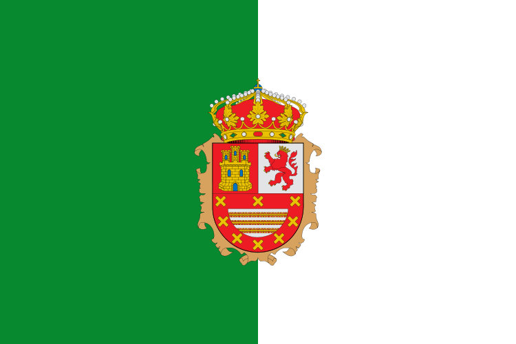
Fuerteventura es una isla española del archipiélago de Canarias, situada en elocéano Atlántico, a 97 km de la costa noroeste de África. El 26 de mayo de 2009 fue declarada en su totalidad reserva de la biosfera por la Unesco.
Pertenece a la provincia de Las Palmas, una de las dos que componen Canarias,comunidad autónoma de España. La capital de la isla es Puerto del Rosario (Puerto Cabras hasta 1956), donde se encuentra elCabildo Insular, que es el gobierno de la isla.
El nombre indígena de la isla, antes de su conquista en el siglo XV, era Erbani, con sus dos comarcas (Jandía y Maxorata), de donde deriva el gentilicio majorero(originalmente majo o maxo). Fuerteventura es la isla más extensa de su provincia, y la segunda de Canarias. Es, desde el punto de vista geológico, la isla más antigua del archipiélago.
Esta inafortunada isla de Fuerteventura, donde entre la apacible calma del cielo y del mar escribimos este comentario a la vida que pasa y a la que se queda, mide en lo más largo, de punta norte a punta sur, cien kilómetros, y en lo más ancho, veinticinco. En su extremo suroeste forma una península casi deshabitada, por donde vagan, entre soledades desnudas y desnudeces solitarias de la mísera tierra, algunos pastores. A esta península se la conoce por el nombre de Jandía o de la Pared. La pared, o mejor, muralla, que dio nombre a la península de Jandía, y de la que aún se conservan trechos, fue una muralla construida por los guanches para separar los dos reinos en los que la isla Majorata, la de los majoreros, o sea Fuerteventura, estaba dividida, y para impedir las incursiones de uno en otro reino. Y he aquí cómo este pedazo de África sahárica, lanzado en el Atlántico, se permitía tener una península y una muralla como la de China, en cuanto al sentido histórico.
Con estas palabras describía Fuerteventura Miguel de Unamuno al poco de llegar a la isla, donde permaneció desterrado durante unos meses en 1924.
Geografía física
Dunas de Corralejo (La Oliva) e Isla de Lobos desde Montaña Roja.
Fuerteventura junto con la isla hermana de Lanzarote son las más áridas de las Islas, además es la más cercana a la costa africana (97 km). Tiene una superficie de 1.659 kilómetros cuadrados,2 por lo que se trata de la segunda isla más extensa del archipiélago. Al noroeste, a sólo 6 km, se halla la pequeña Isla de Lobos, perteneciente a Fuerteventura, con una superficie de 4,58 kilómetros cuadrados.3
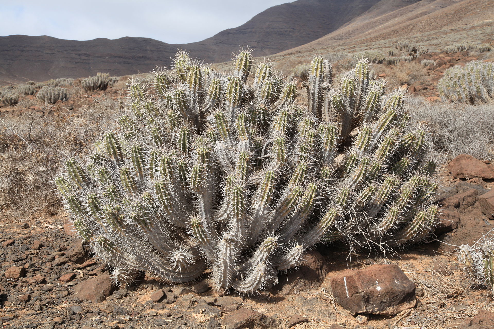
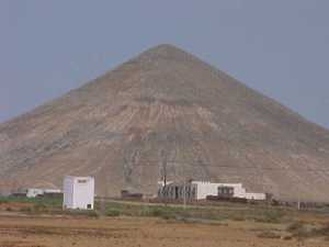
Fuerteventura exhibe extensas planicies, fruto de un intenso proceso erosivo a lo largo de su historia. Es la isla más antigua del archipiélago, habiendo experimentado numerosas erupciones volcánicas. Según establece la Red Canaria de Espacios Naturales Protegidos, 47.695 ha de la isla de Fuerteventura están ocupadas por 13 espacios naturales protegidos,4como las zonas cubiertas de lava del Malpaís Grande y Chico, el lugar de interés científico localizado en el Saladar de Jandía o el monumento natural de la Montaña de Tindaya, por ejemplo.
En la zona central se encuentra el macizo de Betancuria, con una cota máxima de 762 m en el Pico de la Atalaya. Al sur se hallan el istmo de la Pared y la península de Jandía, con el Pico de la Zarza a 807 m de altitud.5 Este último es el monte más elevado de la isla.
Faro de La Entallada, en Las Playitas (Tuineje)
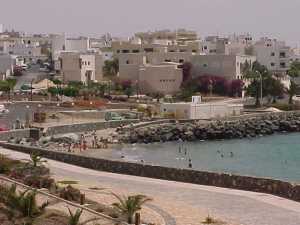
La longitud de costa de Fuerteventura es de casi 326 kilómetros, de los cuales 77 son de playa, lo que la sitúa en segundo lugar en cuanto a longitud del litoral, trasTenerife, y en primer lugar en lo que respecta a perímetro de playas de las islas.6 En torno a las dos terceras partes de las playas son largas y de arena blanca o negra, siendo el resto de cantos rodados o mezcla de cantos y arena. Pájara, al sur, cuenta con 136 km de costa. En el municipio se encuentran las playas de la Península de Jandía, las más extensas de Canarias, que van desde Costa Calma, pasando por Esquinzo-Butihondo, Morro Jable y el Puertito de la Cruz, hasta la Punta de Jandía, por la zona de Sotavento y desde la Punta de Jandía, pasando por Cofete hasta La Pared, por la zona de Barlovento. Al norte, con 90 km, La Oliva es el segundo municipio en longitud de costa de la isla, donde destacan las dunas de Corralejo, El Cotillo y Majanicho. La costa está jalonada por varios faros, entre los que destaca elFaro de La Entallada por su arquitectura y por sus 196 m de altitud sobre el nivel del mar, que lo convierten en uno de los más elevados de las islas.7

Lista de volcanes más conocidos
Volcanes de Fuerteventura
| Volcán |
Tipo de volcán |
Coordenadas |
| Montaña de La Arena |
Cono volcánico |
28.632771° -13.928624° |
| Caldera de los Arrabales |
Cono de cenizas |
28.299039° -13.989678° |
| Bayuyo |
Respiradero |
28.694025° -13.890520° |
| Montaña Bermeja |
Cono volcánico |
28.510733° -14.009956° |
| Calderas, Las |
Caldera |
28.709940° -13.904607° |
| Calderas Blancas |
Cono volcánico |
28.642129° -13.866011° |
| Montaña Caimán |
Cono volcánico |
28.624659° -13.866706° |
| Montaña de La Caldereta |
Cono volcánico |
28.522939° -13.920001° |
| Montaña de Escangraga |
Cono volcánico |
28.620703° -13.890565° |
| Caldera Encantada |
Cono volcánico |
28.704708° -13.907624° |
| Caldera de Gairía |
Cono volcánico |
28.359519° -14.017791° |
| Calderón Hondo |
Cono volcánico |
28.700534° -13.920188° |
| Caldera de La Laguna |
Cono volcánico |
28.331702° -13.992902° |
| Caldera de Liria |
Cono volcánico |
28.321771° -13.993076° |
| Isla de Lobos |
Caldera |
28.750168° -13.822245° |
| Montaña Piedra del Sal |
Cono volcánico |
28.543691° -13.941552° |
| Montaña Quemada |
Cono volcánico |
28.569357° -13.984919° |
| Calderilla Roja |
Caldera |
28.640211° -13.841521° |
| Montaña de Los Saltos |
Cono volcánico |
28.630910° -13.917352° |
| Montaña de San Andrés |
Cono volcánico |
28.522530° -13.939186° |
| Montaña Tamacite |
Cono volcánico |
28.307355° -14.043742° |
| Montaña Temerejeque |
Cono volcánico |
28.545061° -13.920992° |
| Montaña Tindaya |
Cono volcánico |
28.595373° -13.977365° |
| Montaña Tirba |
Cono volcánico |
28.262364° -14.090702° |
Clima
El clima es subtropical árido y las temperaturas permanecen casi constantes durante todo el año (20,4 °C de temperatura media8 ). Las precipitaciones son escasas en la mayor parte de la superficie de la Isla, existiendo algunas excepciones, como el Macizo de Betancuria, Cordillera de Jandía, y los altos de las montañas de El Cardón, La Muda y El Aceitunal. Fuerteventura, junto con Lanzarote son las islas más áridas del Archipiélago Canario. Debido a la baja altitud que presentan estas islas no retiene las masas de aire húmedo, como sucede en otras islas del archipiélago. También la cercanía de la zona de altas presiones de las Azores determina el clima en Fuerteventura. Los vientos dominantes son del noreste o del norte.
El clima en el Macizo de Betancuria (762 m), la Cordillera de Jandía (807 m), y los altos de las montañas de El Cardón (616m), El Aceitunal (686 m) y La Muda (689 m), presentan notables diferencias pluviométricas y térmicas con respecto al resto de la isla. Las formaciones de nubes son más frecuentes y la humedad más destacable.
Un fenómeno común a todas las islas pero con mayor incidencia en las orientales, debido a la proximidad de la costa africana, es la calima, nombre por el que se conoce en Canarias al polvo en suspensión generado por las tormentas de arena del Sahara, que llega a las islas traído por el siroco.
[ocultar] Parámetros climáticos promedio de Fuerteventura Parámetros climáticos promedio de Fuerteventura  |
| Mes |
Ene |
Feb |
Mar |
Abr |
May |
Jun |
Jul |
Ago |
Sep |
Oct |
Nov |
Dic |
Anual |
| Temperatura máxima absoluta (°C) |
28.5 |
30.8 |
32.9 |
36.2 |
33.4 |
38.6 |
37.7 |
41.0 |
37.6 |
36.2 |
34.8 |
29.5 |
41.0 |
| Temperatura máxima media (°C) |
20 |
21 |
23 |
23 |
23.5 |
25 |
27 |
27 |
27 |
25 |
23.5 |
21 |
23.8 |
| Temperatura media (°C) |
17.0 |
17.5 |
19.0 |
19.0 |
20.0 |
21.5 |
23.5 |
24.0 |
23.5 |
22.0 |
20.2 |
18.0 |
20.4 |
| Temperatura mínima media (°C) |
14 |
14 |
15 |
15 |
16.5 |
18 |
20 |
21 |
20 |
19 |
17 |
15 |
17 |
| Temperatura mínima absoluta (°C) |
9.0 |
9.2 |
8.4 |
10.8 |
12.6 |
15.4 |
16.3 |
15.0 |
17.0 |
14.0 |
11.0 |
10.0 |
8.4 |
| Precipitacióntotal (mm) |
17 |
17 |
14 |
6 |
1 |
0 |
0 |
0 |
3 |
9 |
12 |
26 |
105 |
| Días de lluvias (≥ ) |
4 |
3 |
2 |
1 |
1 |
0 |
0 |
0 |
1 |
2 |
3 |
5 |
22 |
| Horas de sol |
201.5 |
196 |
232.5 |
240 |
279 |
285 |
310 |
310 |
270 |
248 |
210 |
201.5 |
2983.5 |
| Humedad relativa (%) |
68 |
69 |
68 |
65 |
63 |
65 |
67 |
70 |
71 |
71 |
69 |
69 |
67.9 |
| Fuente: Tiempo en Fuerteventura9 10 |
Fuente:
http://es.wikipedia.org
________________________…………………………………====================================
FUERTEVENTURA
Fuerteventura (pronounced: [fweɾteβenˈtuɾa]; loosely translated as “Strong Winds” or a corruption of the French term for “Great Adventure”)[1] is one of the Canary Islands, in the Atlantic Ocean off the coast of Africa, politically part of Spain. At 1,660 square kilometres (641 sq mi), it is the second largest of the Canary Islands, after Tenerife. It was declared a biosphere reserve by UNESCO in May 2009.
History
Precolonial history
The first settlers are believed to have arrived here from North Africa – the wordMahorero (Majorero) or Maho is still used today to describe the people of Fuerteventura and comes from the ancient word ‘mahos’ meaning a type of goatskin shoe worn by the original inhabitants. They lived in caves and semi-subterranean dwellings, a few of which have been discovered and excavated revealing relics of early tools and pottery. In antiquity, the island was known as Planaria, among other names, in reference to the flatness of most of its landscape.
In the 11th century BC, the Phoenician settlers arrived in Fuerteventura andLanzarote. Several Spanish and Portuguese expeditions occurred in about 1340 around the island and the island were inhabited by Maurs and were afflicted with European slave holders. By the time of the conquest, the island was divided into twoGuanches kingdoms, one following the king Guize and the other Ayoze. The territories of these tribes were called Maxorata (in the north) and Jandía (in the south). The kingdoms were separated by a wall whose remains are still preserved today. The wall crossed the La Pared isthmus. The ancient name for the island, Erbania, refers to that wall.
The conquest
The conquest began in 1402, commanded by Jean de Béthencourt and Gadifer de la Salle.[2] They arrived with only 63 sailors out of the original 283 as so many had deserted. After arriving and settling in Lanzarote, the invaders made their first excursions to the neighbouring islands. In 1404, Bethencourt and Gadifer foundedBetancuria, the first settlement on the island. After numerous difficulties, Gadifer took charge of the invasion, while Bethencourt went to the Spanish peninsula to seek the recognition and support of the Castilian king.
In 1405, the French conqueror Jean de Béthencourt completed his conquest of the island and gave his name to the former capital, Betancuria, on the west coast (Puerto Rosario took over the mantle as island capital in 1835). The name of the island itself comes from fuerte (strong) and ventura (wind) as mentioned by mallorcan navigator Angelino Dulcert in 1339.
The first census showed a population of 1,200 inhabitants. Following that, the population increased gradually. In 1476 the territory became the Señorío Territorial de Fuerteventura, a subject of the Catholic Monarchs.[3]Over the years, the island has been invaded by the Spanish, French and the English.
Colonial Fuerteventura
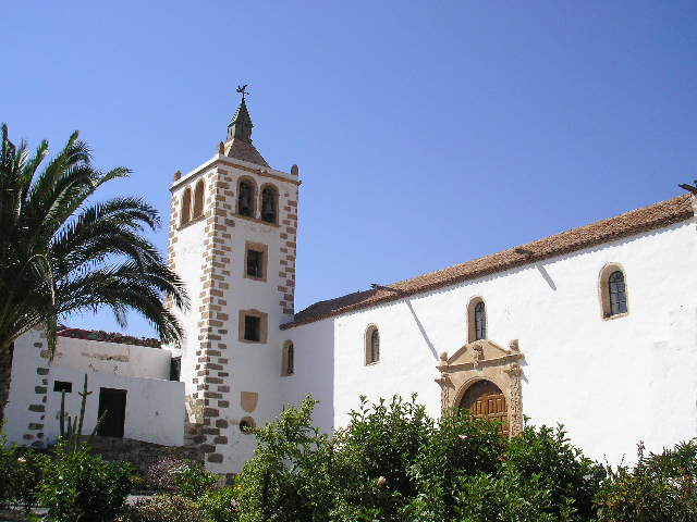
The island suffered from various pirate incursions. A Berber expedition invaded in 1593, sweeping as far as the capital. Various castles were built to protect against this type of attack. The castles were built all along the coast. The population all moved inland as a second protective measure. Because of the invasions, the first Captain General was sent to Fuerteventura, charged with defending the island in the name of the crown. With him came a number of Sergeant Majors. Betancuria became the religious capital of the island[4]
The military regiment was created in 1708. Its colonel assumed the title of Governor at Arms, a hereditary lifetime appointment which stayed in the hands of the Sánchez-Dumpiérrez family. Over time they acquired more power in the other islands through the family of Arias de Saavedra, the Lady of Fuerteventura.[5] The same year, the religious leader created the Assistant Parish of La Oliva and Pájara, to launch in 1711. On 17 December 1790 he created the Assistant Parish of Tuineje, which became a new parish division on 23 June 1792 under the bishop Tavira with lands including part of the Jandía peninsular with a population of 1,670 inhabitants. In 1780 the barrilla growing economy began.[6]
In 1852, the free trade zone was extended by Isabella II to the Canary Islands. The military rule over the island which began from 1708 dissolved in 1859 and Puerto de Cabras (now Puerto del Rosario) became entirely the new capital.

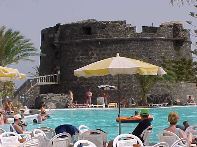
Caleta de Fuste and its castle.
The Canary Islands obtained the right to self-govern in 1912.
In 1927, Fuerteventura and Lanzarote became part of the province of Gran Canaria.
By the 1940s the island had an airport (just west of Puerto del Rosario on the road to Tindaya, still visible today).
Tourism arrived in the mid-1960s with the building of the present airport at El Mattoral and the first tourist hotels.
The seat of the island government (cabildo insular) is in Puerto del Rosario. A total of 74,983 people (2003) live on the island.
Since the island is close to Africa, many illegal immigrants try to enter the European Union through it, by a dangerous boat trip from Morocco.
Environment
Geography
The elongated island has an area of 1,660 km2 (641 sq mi). The island is 100 kilometres (62 miles) long and 31 kilometres (19 miles) wide. It is part of the province of Las Palmas. It is divided into six municipalities:
100 individual settlements are distributed through these municipalities. A nearby islet, Islote de Lobos, is part of the municipality of La Oliva.
Located just 100 km (62 mi) off the coast of north Africa, it is the second biggest of the islands, after Tenerife, and has the longest beaches in the archipelago. The island is a destination for sun, beach and watersports enthusiasts. It lies on the same latitude as Florida and Mexico and temperatures here rarely fall below 18 °C (64 °F) or rise above 32 °C (90 °F). There are no fewer than 152 beaches along its coastline — 50 km (31 mi) of fine, white sand and 25 km (16 mi) of black volcanic shingle.
Geology
Fuerteventura is the oldest island in the Canary Islands dating back 20 million years to a volcanic eruption from the Canary hotspot. The majority of the island was created about 5 million years ago and since then has been eroded by wind and weather. On the seabed off the west coast of the island rests a block of rock 22 km (14 mi) long and 11 km (7 mi) wide, which appears to have slid off the island largely intact at some point in prehistory, similar to the predicted future collapse of Cumbre Vieja, a geological fault on the neighboring island, La Palma. The last volcanic activity in Fuerteventura was between 4,000 and 5,000 years ago.
The highest point in Fuerteventura is Mount Jandía (807 m) in the southwestern part of the island. Geographical features include Istmo de la Pared which is 5 km (3 mi) wide and is the narrowest part of Fuerteventura. The island is divided into two parts, the northern portion which is Maxorata and the southwestern part called the Jandía peninsula.
Beaches
Fuerteventura was chosen among 500 European destinations by the Quality Coast International Certification Program of the European Coastal and Marine Union as one of the most attractive tourist destinations for visitors interested in cultural heritage, environment and sustainability.[7]
Climate

The black-sand beach at
Ajuy.
The climate on Fuerteventura is pleasant throughout the year. The island is also often referred to as the island of eternal spring. The sea adjusts the temperature making the hotSahara winds blow away from the island. The island’s name in English translates as “strong fortune” or “strong wind”, the Spanish word for wind being viento. During the winter months, temperatures average a high of 22 °C (72 °F) and a low of around 15 °C (59 °F), whereas during the summer a mean high of 28 °C (82 °F) and a low of 20 °C (68 °F) can be expected. Precipitation is about 147 mm (6 in) per year, most of which falls in autumn and winter. October is the month with highest rainfall.
A sandstorm known as the Calima (similar to the Sirocco wind that blows North from the Sahara into Europe) blows southwestward from the Sahara Desert and can cause high temperatures, low visibility and drying air. Temperatures during this phenomenon rise temporarily by approximately 10 degrees Celsius. The wind brings in fine white sand, visibility can drop to between 100 to 200 m (328.08 to 656.17 ft) or even lower and can even bring African locusts to the island.
Fuente:
http://es.wikipedia.org


.jpg)