
Decolonization
INGLÉS ESPAÑOL
TRADUCCIÓN DE PALABRA O FRASE Nº 27:
‘PALABRA’ nombre ‘WORD’ :
¿qué quiere decir esta palabra? What does this word mean? ;
te doy mi palabra, I give you my word ; no dijo ni una palabra , she didn’t say a word
DECOLONIZATION
The growth of the movement nationalist anti-colonial territories in the subjects during the first half of the twentieth century challenged an imperial power, which increasingly had to worry about matters closer, especially after the Second World War . Taking this opportunity, first India and other territories after her Asia and Africa claimed become independent states. After several disastrous attempts to avoid it, The United Kingdom of Great Britain and Northern Ireland had to accept the new situation that led to former empire to become what today is the Commonwealth .
The end of the Empire joined the economic problems that the UK had to face since the end of World War II. The economic crisis of 1947 forced the Labour government of Clement Attlee to leave the position of world power and to accept the strategic dominance of the United States . UK embarked on a tortuous realignment with Western Europe awaits a definitive solution .
The declaration of hostilities against Germany in September 1939 did not commit more domains than Australia, which has not had legally adopted the Statute of Westminster. Other domains declared war so independent, except Eire , who had negotiated the withdrawal of British forces from its territory the previous year and preferred to be neutral during the war.
The Second World War weakened the already weak financial and commercial leadership in the UK, emphasizing the importance of domains and the United States as a source of military assistance. Australian Prime Minister John Curtin took the unprecedented decision in 1942 to withdraw Australian troops defending Burma showing that it could not expect governments domains act in defense of the mother country and not their own national interests.


After the war, Australia and New Zealand joined the United States through regional security treaty (ANZUS) in 1951 . The United Kingdom of Great Britain and Northern Ireland sought from 1961 which got in 1973 , joining the European Community , weakening trade links with domains in terms of their privileged access to the British market.
In the Caribbean, Africa, Asia and the Pacific, postwar decolonization was made in haste, given the growth of increasingly powerful nationalist movements. UK rarely fought to retain some territory. The limitations of the United Kingdom were humiliating way during the Suez Crisis of 1956 in which the United States opposed the Anglo-French intervention in Egypt; since that adventure could jeopardize U.S. interests in the Middle East .
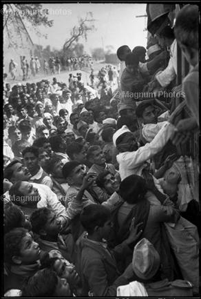
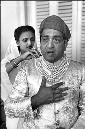
After World War II the continuity of English rule in India was very difficult both financially and in the case of the great famine of Bengal between 1943 and 1944 or the great inflaction accentuating social inequality, impoverishing employees and enriching agricultural and industrial owners. All this social malaise in 1946 sparked strikes, popular uprisings, riots and a peasant revolt promoted by the Communist Party. This crisis led Britain to pursue the policy of abandonment but ran into the problem of making effective emancipation since they had promoted policies to promote the division of the natives to exercise dominion more easily causing Hindus, Muslims and Sikhs do not reach an agreement. In March 1947 Attlee appointed Mountbatten Viceroy in India to formalize independence in June 1948. As the fighting did not stop and were ever greater to avoid a possible civil war the decision to accelerate the process volume and full British parlamentro approval and acceptance of Muslims, Hindus and Sikhs, Mountbatten announced it would deliver power 10 months ahead of schedule, on August 15, 1947. was forced to join one of the two entities created, India or Islamic Pakistan. Since an agreement between the two sides was impossible, the British lawyer Cyril Radcliffe as a neutral figure with the aim of establishing borders availing of maps, prints and religious census data was chosen to determine the origin of the territories since they did not know the place. On August 9, plotting the border was now final but was not made public until depues Aug. 15 (two days later to proclaim the independence of India) since the British did not want to assume the responsibilities of the disturbances the distribution would cause. After several confrontations, the first war between India and Pakistan between 1947 and 1948 led to the Security Council of the UN to take the decision to split the territory between India and Pakistan, a conflict that is still valid.
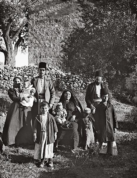
Burma gained independence in 1948 outside the Commonwealth, Ceylon (1948) and Malaya 1957 within the same. The British mandate in Palestine ended in 1948 with the withdrawal of troops and an open war between the Arab population and the Jewish population of the territory. In addition to the proclamation of the states of Israel and Jordan .
In the Mediterranean , Cypriot guerrilla promoted by supporters of union with Greece ended in 1960 with Cyprus independent.
Also in the Mediterranean : Malta was British from 1814 by the Treaty of Paris , obtained its independence on September 21 of 1964 . According to the 1964 constitution, Malta remained the sovereign Queen Elizabeth II with governor general exercised executive authority on her behalf. But on December 13 of 1974 , Malta became a republic within the Commonwealth , with the President as head of state.
The end of the British Empire in Africa came with exceptional rapidity, often leaving the new states in a bad position to tackle the challenges posed sovereignty: The independence of Ghana in ( 1957 ) after ten years of political struggle, was followed by that of Nigeria ( 1960 ), Sierra Leone and Tanganyika ( 1961 ), Uganda ( 1962 ), Kenya and Zanzibar ( 1963 ), Gambia ( 1965 ), Botswana (formerly Bechuanaland) and Lesotho (formerly Basutoland) ( 1966 ), Mauritius ( 1968 ), Swaziland ( 1968 ) and Seychelles ( 1976 ).
A British withdrawal from southern and eastern Africa complicated the situation of white settlers in the regions: The Mau Mau uprising in Kenya had already shown the potential for conflict in a context in which whites were reluctant landowners to democratic reforms. The white minority government in South Africa remained a headache for the Commonwealth to the end system apartheid in 1994 .

Although the Federation of Rhodesia and Nyasaland , dominated by whites, ended with the independence of Malawi (formerly Nyasaland ) and Zambia (formerly Northern Rhodesia ) in 1964 , the white minority in Southern Rhodesia , (a self-governing colony since 1923 ) declared independence Republic of Rhodesia . Government support of South Africa remained the regime until 1979 , year in which an agreement based on the will of the majority, which was reached emerged an independent Zimbabwe .
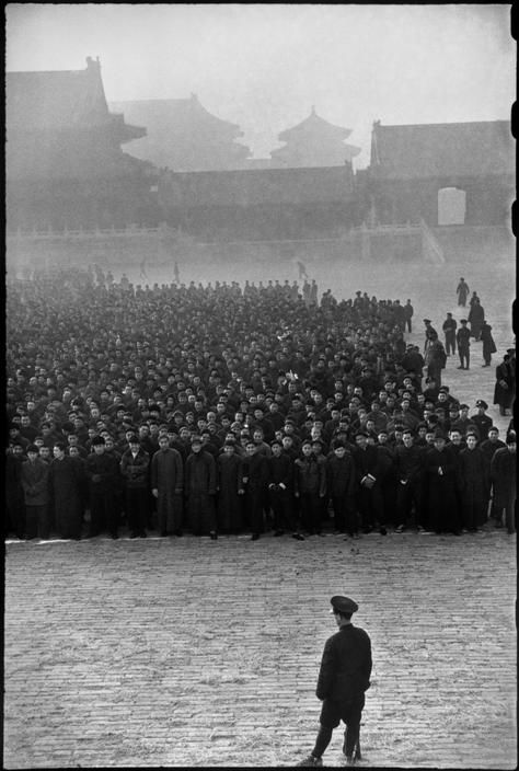
Most of the British territories in the Caribbean chose independence separately, after the failure of the Federation of the West Indies ( 1958 – 1962 ): a Jamaica and Trinidad and Tobago (1962) the continued Barbados ( 1966 ) and smaller eastern Caribbean islands gained independence in the seventies and eighties. At the end of the assignment for 99 years in the New Territories, all Hong Kong was returned to China in 1997 .
*******************************************************
Descolonización
El crecimiento de los movimientos nacionalistas anticolonialistas en los territorios súbditos durante la primera mitad del siglo XX desafió a una potencia imperial, que cada vez tenía que preocuparse más por asuntos más cercanos, en especial tras la Segunda Guerra Mundial. Aprovechando esta oportunidad, primero la India, y tras ella otros territorios de Asia y de África reclamaron convertirse en estados independientes. Tras algunos intentos desastrosos de evitarlo, El Reino Unido de Gran Bretaña e Irlanda del Norte tuvo que aceptar la nueva situación que condujo al antiguo Imperio a convertirse en lo que hoy en día es la Commonwealth.
El final del Imperio se unió a los problemas económicos que el Reino Unido tuvo que afrontar tras el fin de la Segunda Guerra Mundial. La crisis económica de 1947 obligó al gobierno laborista de Clement Attlee a abandonar el puesto de primera potencia mundial y a aceptar la preponderancia estratégica de los Estados Unidos.Reino Unido se embarcó en un tortuoso realineamiento con Europa Occidental que permanece a la espera de una solución definitiva.
La declaración de hostilidades contra Alemania en septiembre de 1939 no comprometía a más dominios que a Australia, que aún no había adoptado legalmente el Estatuto de Westminster. Los otros dominios declararon la guerra de modo independiente, excepto Eire, que había negociado la retirada de las fuerzas británicas de su territorio el año anterior y que prefirió ser neutral durante la guerra.
La segunda Guerra Mundial debilitó el ya débil liderazgo financiero y comercial de Reino Unido, acentuando la importancia de los dominios y de los Estados Unidos como fuente de asistencia militar. El primer ministro australiano John Curtin tomó la decisión sin precedentes en 1942 de retirar las tropas australianas que defendían Birmania demostrando que no se podía esperar que los gobiernos de los dominios actuaran en defensa de la metrópoli y no de sus propios intereses nacionales.
Tras la guerra, Australia y Nueva Zelanda se unieron a los Estados Unidos a través del tratado regional de seguridad (ANZUS), en 1951. El Reino Unido de Gran Bretaña e Irlanda del Norte buscaba desde 1961 lo que consiguió en 1973, unirse a la Comunidad Europea, lo que debilitó los vínculos comerciales con los dominios en lo referente a su acceso privilegiado al mercado británico.
En el Caribe, África, Asia y el Pacífico, la descolonización durante la posguerra se efectuó con prisa, dado el crecimiento de los cada vez más poderosos movimientos nacionalistas. Reino Unido rara vez luchó para retener algún territorio. Las limitaciones del Reino Unido se mostraron de modo humillante durante la Crisis de Suez de 1956 en la que los Estados Unidos se opusieron a la intervención anglo-francesa en Egipto; puesto que aquella aventura podía poner en riesgo los intereses estadounidenses en el Próximo Oriente.


Después de la segunda guerra mundial la continuidad del dominio inglés sobre la India era muy difícil tanto económicamente como es el caso de la gran hambruna de Bengala entre 1943 y 1944 o las gran inflacción que acentuó las desigualdades sociales, empobreciendo a los asalariados y enriqueciendo a los propietarios agrícolas e industriales. Todo este mal estar social hizo estallar en 1946 huelgas, movimientos populares, motines y una gran revuelta campesina promovida por el Partido Comunista. Esta situación de crisis llevó a Gran Bretaña a ejercer la política de abandono pero toparon con el problema de hacer efectiva la emancipación puesto que habían promovido políticas de fomento de la división de los nativos para ejercer un dominio con mayor facilidad causando que hindúes, musulmanes y sijs no llegaran a un acuerdo. En marzo de 1947 Attlee nombró a Mountbatten virrey en la India con objetivo de formalizar la independencia en junio de 1948. Como los enfrentamientos no cesaban y cada vez eran mayores para evitar una posible guerra civil se tomo la decisión de acelerar el proceso y con plena aprobación del parlamentro británico y con la aceptación de musulmanes, hindúes y sijs, Mountbatten anunció que entregaria el poder 10 meses antes de lo previsto, el 15 de agosto de 1947. Se obligó a integrarse en una de las dos entidades creadas, la India o el Pakistán islámico. Puesto que un acuerdo entre ambos bandos era imposible, se eligió al abogado inglés Cyril Radcliffe como figura neutral con el objetivo de establecer fronteras valiendose de mapas, antiguos censos y datos religiosos para determinar el origen de los territorios puesto que no conocia el lugar. El 9 de agosto el trazado de la frontera ya era definitivo pero no se hizo público hasta el depúes del 15 de agosto (dos días más tarde de proclamar la independencia de la India) puesto que los británicos no querían asumir las responsabilidades de los disturbios que el reparto iba a causar. Tras varios enfrentamientos, la primera guerra entre la India y Pakistán entre 1947 y 1948 llevó al Consejo de Seguridad de la ONU a tomar la decisión de dividir el territorio entre la India y Pakistán, conflicto que sigue estando vigente.
Birmania obtuvo la independencia en 1948 fuera de la Commonwealth, Ceilán (1948) y Malaya 1957 dentro de la misma. El mandato Británico en Palestina concluyó en 1948 con la retirada de las tropas y una guerra abierta entre la población árabe y la población judía del territorio. Además con la proclamación de los estados de Israel y Jordania.
En el Mediterráneo, la guerrilla chipriota promovida por partidarios de la unión con Grecia concluyó en 1960 con un Chipre independiente.
También en el Mediterráneo: Malta que fue británica desde 1814 por el Tratado de París, obtiene su independencia el 21 de septiembre de 1964. Según la Constitución de 1964, Malta mantuvo como soberana la Reina Isabel II con un gobernador general ejerció la autoridad ejecutiva en su nombre. Pero el 13 de diciembre de 1974, Malta se transformó en una república dentro de la Commonwealth, con un Presidente como jefe de estado.
El final del Imperio británico en África llegó con una rapidez excepcional, a menudo dejando a los nuevos estados en una mala situación para abordar los retos que planteaba la soberanía: La independencia de Ghana en (1957) tras diez años de lucha política, fue seguida por la de Nigeria (1960), Sierra Leona y Tanganyika (1961), Uganda (1962), Kenia y Zanzíbar (1963), Gambia (1965), Botsuana (antigua Bechuanalandia) y Lesoto (antigua Basutolandia) (1966), Mauricio (1968), Suazilandia (1968) y Seychelles (1976).
A la retirada británica del sur y del este de África la complicaba la situación de los pobladores blancos de las regiones: El levantamiento Mau Mau en Kenia ya había mostrado las posibilidades de conflicto, en un contexto en el que los blancos eran terratenientes reluctantes a las reformas democráticas. El gobierno minoritario de los blancos en Sudáfrica continuó siendo un quebradero de cabeza para la Commonwealth hasta el final del sistema de apartheid en 1994.
Aunque la Federación de Rhodesia y Nyasaland, dominada por los blancos, concluyó con la independencia de Malaui (antigua Nyasaland) y Zambia (antigua Rodesia del Norte) en 1964, la minoría blanca de Rodesia del Sur, (una colonia autogobernada desde 1923) declaró su independencia República de Rodesia. El apoyo del gobierno de Sudáfrica mantuvo el régimen hasta 1979, año en el que se alcanzó un acuerdo, basado en la voluntad de la mayoría, del que surgió un independiente Zimbabue.
La mayor parte de los territorios británicos en el Caribe optó por una independencia por separado, tras el fracaso de la Federación de las Indias Occidentales (1958–1962): a Jamaica y Trinidad y Tobago (1962) las siguió Barbados (1966) y las islas más pequeñas del Caribe oriental alcanzaron la independencia en los años setenta y ochenta. Al final de la cesión por 99 años de los Nuevos Territorios, todo Hong Kong fue devuelto a China en 1997.