Cantabria
Cantabria es una comunidad autónoma española de carácter uniprovincial referida como «comunidad histórica» en su Estatuto de Autonomía.2 Limita al este con el País Vasco (provincia de Vizcaya), al sur conCastilla y León (provincias de León, Palenciay Burgos), al oeste con elPrincipado de Asturias y al norte con el mar Cantábrico. La ciudad de Santander es su capital y localidad más poblada.
Sus primeras referencias datan del año 195 a. C., momento en que el escritor romanoCatón el Viejo habla en su obra Orígenes del nacimiento del río Ebro en el país de los cántabros.
[…] fluvium Hiberum: is oritur ex Cantabris, magnus atque pulcher, pisculentus. […] el río Ebro: nace en tierra de cántabros, grande y hermoso, abundante en peces. Marco Porcio Catón, “el Viejo”. Orígenes (VII), 195 a. C.
Cantabria está situada en la cornisa Cantábrica, nombre dado a la franja de tierra existente entre el mar Cantábrico y la cordillera Cantábrica, en el norte de laPenínsula Ibérica. Posee un clima oceánico húmedo y de temperaturas moderadas, fuertemente influenciado por los vientos delocéano Atlántico que chocan contra las montañas. La precipitación media es de 1200 mm, lo que permite el crecimiento de frondosa vegetación. Su mayor elevación se localiza en el pico de Torre Blanca (2619metros)3 nota 1 La comunidad está compuesta por 102 municipios y posee un exclave en Vizcaya, Valle de Villaverde.
Cantabria es una comunidad rica en yacimientos arqueológicos del Paleolítico Superior, aunque los primeros signos de ocupación humana datan del Paleolítico Inferior. Destacan en este aspecto las pinturas de lacueva de Altamira, datadas en el 37 000 a. C.4 y declarada, junto a otras nueve cuevas cántabras más, Patrimonio de la Humanidad por la Unesco.
La moderna provincia de Cantabria se constituyó el 28 de julio de 1778 en la Casa de Juntas dePuente San Miguel.5 6 7 8 9 La Ley Orgánica del Estatuto de Autonomía de Cantabria se aprobó el30 de diciembre de1981, dotando de este modo a lacomunidad autónoma de organismos e instituciones de autogobierno. Su actualpresidente es Ignacio Diego, del Partido Popular, después de haber ganado laselecciones de 2011con mayoría absoluta.
Toponimia
Diversos han sido los autores que han tratado el origen etimológico del nombre de Cantabria (San Isidoro de Sevilla, Julio Caro Baroja, Aureliano Fernández Guerra,Joaquín González Echegarayy Adolf Schulten, entre otros). Aunque no es segura su procedencia, la opinión más aceptada por los expertos es que deriva de la raíz cant-, de origen celta o ligur y que significa ‘roca’ o ‘piedra’, y el sufijo -abr, frecuente en las regiones celtas. De todo esto se deduce que cántabro vendría a significar ‘pueblo que habita en las peñas’ o ‘montañés’, en clara referencia al territorio abrupto y montañoso de Cantabria.10
Socialmente Cantabria recibe también otros nombres: La Montaña y La Tierruca.
Geografía física
La comunidad posee una superficie de 5.326 km² y sus costas tienen una longitud total de 284 kilómetros. Su cabo más sobresaliente es el Cabo de Ajo (43°29′33″N3°37′15″O). En la comunidad existen tres ámbitos geográficos bien diferenciados: La Marina, La Montaña y Campoo y los valles del sur pertenecientes a las cuencas del río Ebro y del Duero. La presencia predominante de la montaña y su difícil orografía del terreno explica que históricamente además se conozca a la comunidad entera como La Montaña.
Relieve

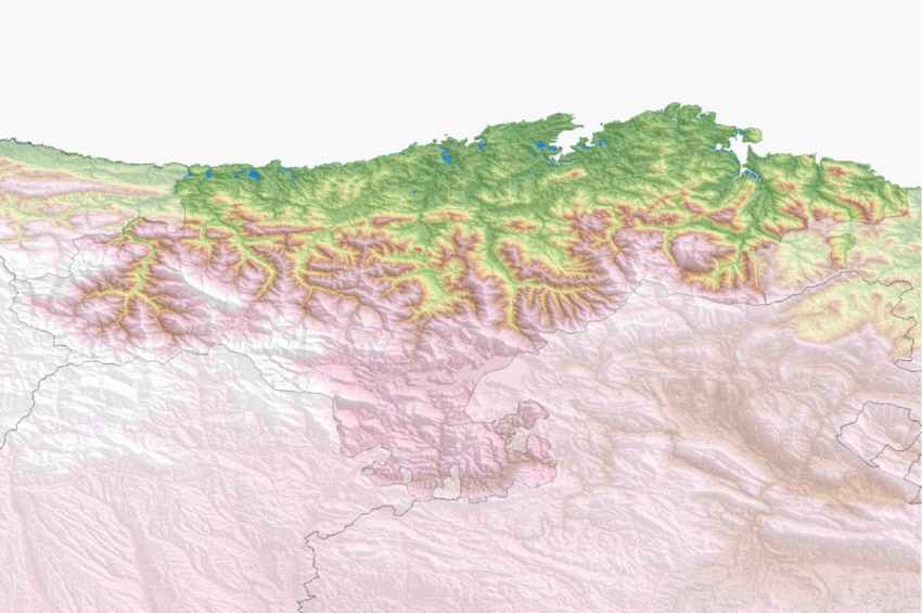
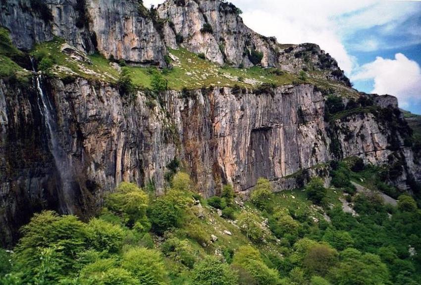
A medida que nos desplazamos hacia el sur el relieve suave de La Marina se torna abrupto hasta alcanzar las altas montañas de la Cordillera Cantábrica (imagen panorámica).
Cantabria (English /kænˈtɑːbriə/, /kænˈtæbriə/; Spanish and Cantabrian: [kanˈtaβɾja]) is aSpanishhistorical community[2] and autonomous community with Santander as its capital city. It is bordered on the east by the Basque Autonomous Community(province of Biscay), on the south byCastile and León (provinces of León, Palenciaand Burgos), on the west by the Principality of Asturias, and on the north by theCantabrian Sea (Bay of Biscay).
Cantabria belongs to Green Spain, the name given to the strip of land between theBay of Biscayand the Cantabrian Mountains, so called because of its particularly lush vegetation, due to the wet and moderateoceanic climate. The climate is strongly influenced by Atlantic Ocean winds trapped by the mountains; the average precipitation is about 1,200 mm (47 inches)
Cantabria is the richest region in the world for archaeological sites from the Upper Paleolithicperiod, although the first signs of human occupation date from the Lower Paleolithic. The most significant site for cave paintings is that in the cave of Altamira, dating from about 37,000 BC[3]and declared, along with nine other Cantabrian caves, as World Heritage Sites by UNESCO.
The modern Province of Cantabria was constituted on 28 July 1778. The Organic Law of theAutonomy Statute of Cantabria was approved on 30 December 1981, giving the region its own institutions of self-government.
Etymology
Numerous authors, including Isidore of Seville, Julio Caro Baroja, Aureliano Fernández Guerra,Joaquín González Echegaray, and Adolf Schulten, have explored the etymology of the name “Cantabria”, yet its origins remain uncertain. It is generally accepted that the root cant- comes from Celtic for “rock” or “stone”, while -abr was a common suffix used in Celtic regions. Thus, “Cantabrian” could mean“people who live in the rocks”or highlanders, a reference to the steep and mountainous territory of Cantabria.[4]
Geography
Relief
Cantabria is a mountainous and coastal region, with important natural resources. It has two distinct areas which are well differentiated morphologically:
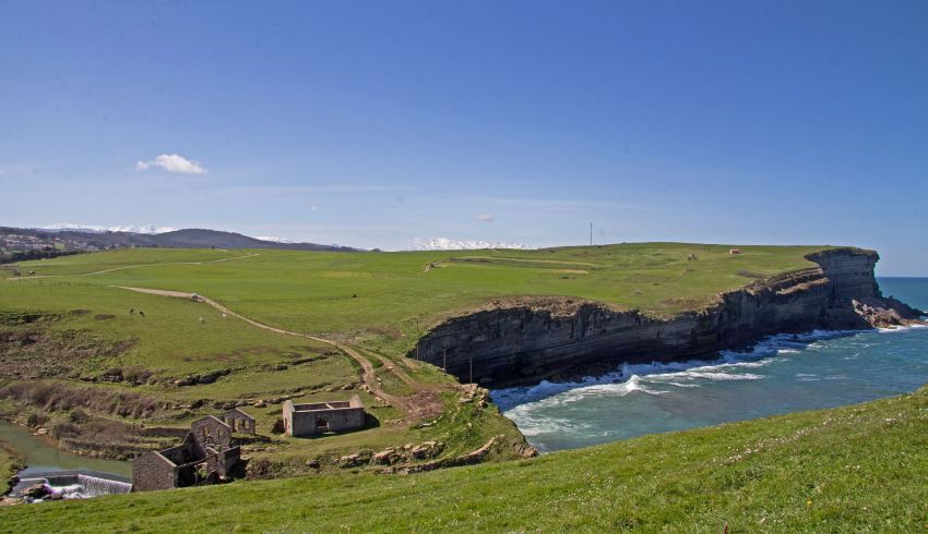
- Coast. A coastal strip of low, wide and gently rolling valleys some 10 kilometres in width, the altitude of which does not rise above 500 metres, and which meets the ocean in a line of abrupt cliffs broken by river estuaries, forming rias and beaches. Santander Bay is the most prominent indentation in the coastline. To the south, the coastal strip rises to meet the mountains.
- Mountains. This is a long barrier made up of abruptly rising mountains parallel to the sea, which are part of the Cantabrian Mountains. The mountains are mostly made of limestonewith karst topography, and occupy most of Cantabria’s area. They form deep valleys running north-south. The torrential rivers are short, fast flowing and of great eroding power, so the slopes are steep. The valleys define different natural regions, delimited physically by the intervening mountain ranges: Liébana, Saja-Nansa, Besaya, Pas–Pisueña,Miera,Asón–Gándara, Campoo. To the ‘mountain’ region belongs the Escudo Range, a mountain range of 600 to 1,000 metres high that covers 15 or 20 km in a parallel line to the coast in the West part of Cantabria.
Towards the south are higher mountains, the tops of which form the watershed between the drainage basins of the Rivers Ebro, Duero and the rivers that flow into the Bay of Biscay. These peaks generally exceed 1,500 m from the Pass of San Glorio in the west to the Pass of Los Tornos in the eastern part: Peña Labra, Castro Valneraand the mountain passes of Sejos, El Escudo and La Sía. The great limestone masses ofPicos de Europa also stand out in the southwest of the region: most of their summits exceed 2,500 m, and their topography is shaped by the former presence ofglaciers.
Fuente:

